 vesseltracker.com
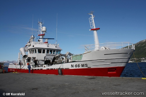
Vessel Rowenta IMO: 9176539, MMSI: 259478000 Fish Carrier
UTC, 68.30147, 15.87917, course: 188, speed: 1.1
UTC, 68.28593, 15.65347, course: 251, speed: 8.7
2026-01-18 10:24:08 UTC, 68.24481, 15.43919, course: 251, speed: 8.9
Live AIS position:
UTC. Near Anfinnsletta),
updated 2026-01-18 10:24:08 UTC.
Find the position of the vessel Rowenta on the map. The latter are known coordinates and path.
marine traffic ship tracker show on live map
The current position of vessel Rowenta is 68.24481 lat / 15.43919 lng. Updated: 2026-01-18 10:24:08 UTCDetails:
Last coordinates of the vessel:
UTC, 68.29809, 15.85329, course: 301, speed: 0.5UTC, 68.30147, 15.87917, course: 188, speed: 1.1
UTC, 68.28593, 15.65347, course: 251, speed: 8.7
2026-01-18 10:24:08 UTC, 68.24481, 15.43919, course: 251, speed: 8.9