 vesseltracker.com
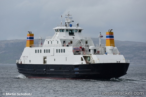
Vessel Torgtind IMO: 9189445, MMSI: 259546000 Passenger Ro Ro Cargo Ship
UTC, 65.65004, 12.17272, course: 155, speed: 12.4
UTC, 65.67726, 12.13211, course: 267, speed: 0
2026-02-02 23:41:15 UTC, 65.67725, 12.13218, course: 267, speed: 0
Live AIS position:
UTC. Near IGEROY),
updated 2026-02-02 23:41:15 UTC.
Find the position of the vessel Torgtind on the map. The latter are known coordinates and path.
marine traffic ship tracker show on live map
The current position of vessel Torgtind is 65.67725 lat / 12.13218 lng. Updated: 2026-02-02 23:41:15 UTCCurrently sailing under the flag of Norway
Torgtind built in 1999 year
Deadweight:
460 tDetails:
Last coordinates of the vessel:
UTC, 65.61909, 12.24645, course: 143, speed: 12.1UTC, 65.65004, 12.17272, course: 155, speed: 12.4
UTC, 65.67726, 12.13211, course: 267, speed: 0
2026-02-02 23:41:15 UTC, 65.67725, 12.13218, course: 267, speed: 0