 vesseltracker.com
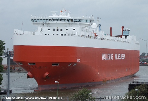
Vessel Tijuca IMO: 9377511, MMSI: 259805000 Vehicles Carrier
UTC, 57.63518, 11.50109, course: 308, speed: 17.7
UTC, 57.89334, 10.43173, course: 267, speed: 18.9
2026-01-29 01:27:19 UTC, 57.89080, 9.88870, course: 267, speed: 19
Live AIS position:
UTC. 18 nm N of Hirtshals),
updated 2026-01-29 01:27:19 UTC.
Find the position of the vessel Tijuca on the map. The latter are known coordinates and path.
marine traffic ship tracker show on live map
The current position of vessel Tijuca is 57.89080 lat / 9.88870 lng. Updated: 2026-01-29 01:27:19 UTCCurrently sailing under the flag of Norway
Tijuca built in 2008 year
Deadweight:
30089 tDetails:
Last coordinates of the vessel:
UTC, 57.68833, 11.86667, course: -1, speed: 0UTC, 57.63518, 11.50109, course: 308, speed: 17.7
UTC, 57.89334, 10.43173, course: 267, speed: 18.9
2026-01-29 01:27:19 UTC, 57.89080, 9.88870, course: 267, speed: 19