 vesseltracker.com
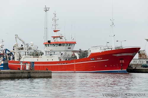
Vessel Rottingoy IMO: 9104976, MMSI: 259845000 Fish Carrier
UTC, 60.14059, 5.37665, course: 221, speed: 0
UTC, 60.14054, 5.37657, course: 221, speed: 0
2026-03-06 13:27:14 UTC, 60.14058, 5.37656, course: 221, speed: 0
Live Vessel Rottingoy Analytics (details, animations, etc.)
Live AIS position: UTC. Near Lepsøy), updated 2026-03-06 13:27:14 UTC.Find the position of the vessel Rottingoy on the map. The latter are known coordinates and path.
marine traffic ship tracker show on live map
The current position of vessel Rottingoy is 60.14058 lat / 5.37656 lng. Updated: 2026-03-06 13:27:14 UTCCurrently sailing under the flag of Norway
Rottingoy built in 1994 year
Deadweight:
130 tDetails:
Last coordinates of the vessel:
UTC, 60.14055, 5.37653, course: 221, speed: 0UTC, 60.14059, 5.37665, course: 221, speed: 0
UTC, 60.14054, 5.37657, course: 221, speed: 0
2026-03-06 13:27:14 UTC, 60.14058, 5.37656, course: 221, speed: 0