 vesseltracker.com
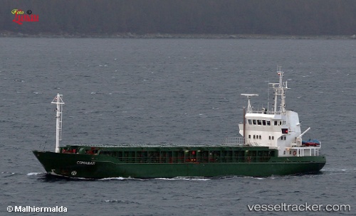
Vessel Comabar IMO: 8411231, MMSI: 259859000 Multi Purpose Carrier
UTC, 59.45880, 24.70688, course: -1, speed: 0
UTC, 59.45878, 24.70685, course: -1, speed: 0
2026-01-30 11:58:29 UTC, 59.45877, 24.70687, course: -1, speed: 0
Live AIS position:
UTC. Near PALJASSAARE ),
updated 2026-01-30 11:58:29 UTC.
Find the position of the vessel Comabar on the map. The latter are known coordinates and path.
marine traffic ship tracker show on live map
The current position of vessel Comabar is 59.45877 lat / 24.70687 lng. Updated: 2026-01-30 11:58:29 UTCCurrently sailing under the flag of Norway
Comabar built in 1985 year
Deadweight:
1117 tDetails:
Last coordinates of the vessel:
UTC, 59.45877, 24.70686, course: -1, speed: 0UTC, 59.45880, 24.70688, course: -1, speed: 0
UTC, 59.45878, 24.70685, course: -1, speed: 0
2026-01-30 11:58:29 UTC, 59.45877, 24.70687, course: -1, speed: 0