 vesseltracker.com
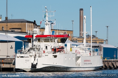
Vessel Seagas IMO: 7382691, MMSI: 265704520 Lng Tanker
UTC, 60.44113, 22.21913, course: 178, speed: 0
UTC, 60.44113, 22.21914, course: 178, speed: 0
2026-03-11 16:00:59 UTC, 60.44112, 22.21913, course: 178, speed: 0
Live Vessel Seagas Analytics (details, animations, etc.)
Live AIS position: UTC. Near Turku), updated 2026-03-11 16:00:59 UTC.Find the position of the vessel Seagas on the map. The latter are known coordinates and path.
marine traffic ship tracker show on live map
The current position of vessel Seagas is 60.44112 lat / 22.21913 lng. Updated: 2026-03-11 16:00:59 UTCCurrently sailing under the flag of Sweden
Seagas built in 1974 year
Deadweight:
203 tDetails:
Last coordinates of the vessel:
UTC, 60.44115, 22.21916, course: 178, speed: 0UTC, 60.44113, 22.21913, course: 178, speed: 0
UTC, 60.44113, 22.21914, course: 178, speed: 0
2026-03-11 16:00:59 UTC, 60.44112, 22.21913, course: 178, speed: 0