 vesseltracker.com
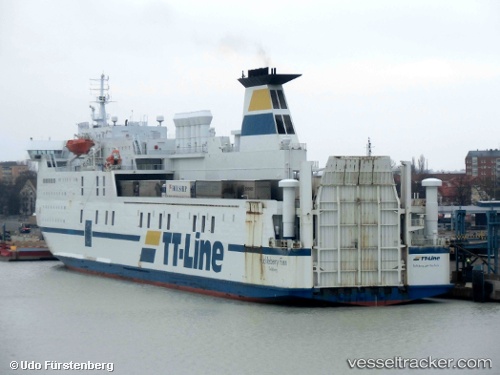
Vessel Huckleberry Finn IMO: 8618358, MMSI: 265874000 Passenger Ro Ro Cargo Ship
UTC, 54.80516, 13.07694, course: 77, speed: 12.4
UTC, 54.95430, 13.81798, course: 76, speed: 12.6
2026-02-02 23:42:35 UTC, 55.19246, 14.40820, course: 45, speed: 15.2
Live AIS position:
UTC. 10 nm W of HASLE),
updated 2026-02-02 23:42:35 UTC.
Find the position of the vessel Huckleberry Finn on the map. The latter are known coordinates and path.
marine traffic ship tracker show on live map
The current position of vessel Huckleberry Finn is 55.19246 lat / 14.40820 lng. Updated: 2026-02-02 23:42:35 UTCCurrently sailing under the flag of Sweden
Huckleberry Finn built in 1988 year
Deadweight:
6080 tDetails:
Last coordinates of the vessel:
UTC, 54.59916, 12.47579, course: 63, speed: 13.6UTC, 54.80516, 13.07694, course: 77, speed: 12.4
UTC, 54.95430, 13.81798, course: 76, speed: 12.6
2026-02-02 23:42:35 UTC, 55.19246, 14.40820, course: 45, speed: 15.2