 vesseltracker.com
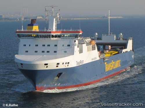
Vessel Tavastland IMO: 9334959, MMSI: 266232000 Ro Ro Cargo Ship
UTC, 54.48202, 10.30806, course: 56, speed: 12.7
UTC, 54.56766, 10.88232, course: 86, speed: 13.9
2026-03-08 05:31:56 UTC, 54.54415, 11.31036, course: 110, speed: 12.8
Live Vessel Tavastland Analytics (details, animations, etc.)
Live AIS position: UTC. Near Bannesdorf), updated 2026-03-08 05:31:56 UTC.Find the position of the vessel Tavastland on the map. The latter are known coordinates and path.
marine traffic ship tracker show on live map
The current position of vessel Tavastland is 54.54415 lat / 11.31036 lng. Updated: 2026-03-08 05:31:56 UTCCurrently sailing under the flag of Sweden
Tavastland built in 2006 year
Deadweight:
15960 tDetails:
Last coordinates of the vessel:
UTC, 54.35020, 9.99725, course: 49, speed: 6.4UTC, 54.48202, 10.30806, course: 56, speed: 12.7
UTC, 54.56766, 10.88232, course: 86, speed: 13.9
2026-03-08 05:31:56 UTC, 54.54415, 11.31036, course: 110, speed: 12.8