 vesseltracker.com
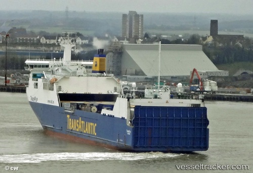
Vessel Thuleland IMO: 9343261, MMSI: 266248000 Ro Ro Cargo Ship
UTC, 51.85105, 2.45874, course: 109, speed: 11.2
UTC, 51.89239, 3.30802, course: 81, speed: 11.6
2026-03-02 03:56:03 UTC, 51.97185, 3.78306, course: 84, speed: 11.4
Live AIS position:
UTC. Near Llanwrda),
updated 2026-03-02 03:56:03 UTC.
Find the position of the vessel Thuleland on the map. The latter are known coordinates and path.
marine traffic ship tracker show on live map
The current position of vessel Thuleland is 51.97185 lat / 3.78306 lng. Updated: 2026-03-02 03:56:03 UTCCurrently sailing under the flag of Sweden
Thuleland built in 2006 year
Deadweight:
13800 tDetails:
Last coordinates of the vessel:
UTC, 51.84239, 2.04004, course: 95, speed: 11.2UTC, 51.85105, 2.45874, course: 109, speed: 11.2
UTC, 51.89239, 3.30802, course: 81, speed: 11.6
2026-03-02 03:56:03 UTC, 51.97185, 3.78306, course: 84, speed: 11.4