 vesseltracker.com
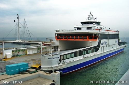
Vessel Yavuz Sultan Selim 1 IMO: 9428750, MMSI: 271000975 Passenger Ro Ro Cargo Ship
UTC, 40.87420, 29.23609, course: 167, speed: 0
UTC, 40.87413, 29.23613, course: 167, speed: 0
2026-03-01 10:05:55 UTC, 40.87420, 29.23613, course: 167, speed: 0
Live AIS position:
UTC. Near PENDIK),
updated 2026-03-01 10:05:55 UTC.
Find the position of the vessel Yavuz Sultan Selim 1 on the map. The latter are known coordinates and path.
marine traffic ship tracker show on live map
The current position of vessel Yavuz Sultan Selim 1 is 40.87420 lat / 29.23613 lng. Updated: 2026-03-01 10:05:55 UTCCurrently sailing under the flag of Turkey
Yavuz Sultan Selim 1 built in 2008 year
Deadweight:
280 tDetails:
Last coordinates of the vessel:
UTC, 40.87423, 29.23609, course: 167, speed: 0UTC, 40.87420, 29.23609, course: 167, speed: 0
UTC, 40.87413, 29.23613, course: 167, speed: 0
2026-03-01 10:05:55 UTC, 40.87420, 29.23613, course: 167, speed: 0