 vesseltracker.com
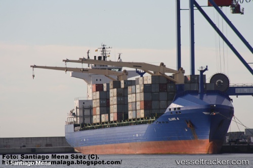
Vessel Claire A IMO: 9379387, MMSI: 271001092 Container Ship
UTC, 42.15190, 41.65234, course: -1, speed: 0
UTC, 42.15189, 41.65231, course: -1, speed: 0
2026-03-07 23:08:41 UTC, 42.15193, 41.65233, course: -1, speed: 0
Live Vessel Claire A Analytics (details, animations, etc.)
Live AIS position: UTC. Near Poti), updated 2026-03-07 23:08:41 UTC.Find the position of the vessel Claire A on the map. The latter are known coordinates and path.
marine traffic ship tracker show on live map
The current position of vessel Claire A is 42.15193 lat / 41.65233 lng. Updated: 2026-03-07 23:08:41 UTCCurrently sailing under the flag of Turkey
Claire A built in 2008 year
Deadweight:
22028 tDetails:
Last coordinates of the vessel:
UTC, 42.15189, 41.65232, course: -1, speed: 0UTC, 42.15190, 41.65234, course: -1, speed: 0
UTC, 42.15189, 41.65231, course: -1, speed: 0
2026-03-07 23:08:41 UTC, 42.15193, 41.65233, course: -1, speed: 0