 vesseltracker.com
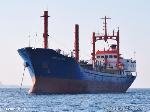
Vessel Haci Rustu K IMO: 7615969, MMSI: 271002018 General Cargo Ship
UTC, 40.90670, 28.40771, course: 76, speed: 8.5
UTC, 40.96449, 28.67804, course: 174, speed: 0.2
2026-03-17 02:32:49 UTC, 40.96451, 28.67793, course: 173, speed: 0
Live Vessel Haci Rustu K Analytics (details, animations, etc.)
Live AIS position: UTC. Near Ambarli), updated 2026-03-17 02:32:49 UTC.Find the position of the vessel Haci Rustu K on the map. The latter are known coordinates and path.
marine traffic ship tracker show on live map
The current position of vessel Haci Rustu K is 40.96451 lat / 28.67793 lng. Updated: 2026-03-17 02:32:49 UTCCurrently sailing under the flag of Turkey
Haci Rustu K built in 1987 year
Deadweight:
2970 tDetails:
Last coordinates of the vessel:
UTC, 40.85789, 28.06574, course: -1, speed: 7.6UTC, 40.90670, 28.40771, course: 76, speed: 8.5
UTC, 40.96449, 28.67804, course: 174, speed: 0.2
2026-03-17 02:32:49 UTC, 40.96451, 28.67793, course: 173, speed: 0