 vesseltracker.com
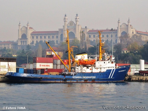
Vessel Alemdar Ii IMO: 6610211, MMSI: 271002064 Tug
UTC, 41.56079, 28.40116, course: -1, speed: 10.2
UTC, 41.61480, 28.33619, course: -1, speed: 9.9
2026-02-24 16:17:02 UTC, 41.61480, 28.33619, course: -1, speed: 9.9
Live AIS position:
UTC. 21 nm SE of IGNEADA),
updated 2026-02-24 16:17:02 UTC.
Find the position of the vessel Alemdar Ii on the map. The latter are known coordinates and path.
marine traffic ship tracker show on live map
The current position of vessel Alemdar Ii is 41.61480 lat / 28.33619 lng. Updated: 2026-02-24 16:17:02 UTCCurrently sailing under the flag of Turkey
Details:
Last coordinates of the vessel:
UTC, 41.34925, 28.73844, course: -1, speed: 9.7UTC, 41.56079, 28.40116, course: -1, speed: 10.2
UTC, 41.61480, 28.33619, course: -1, speed: 9.9
2026-02-24 16:17:02 UTC, 41.61480, 28.33619, course: -1, speed: 9.9