 vesseltracker.com
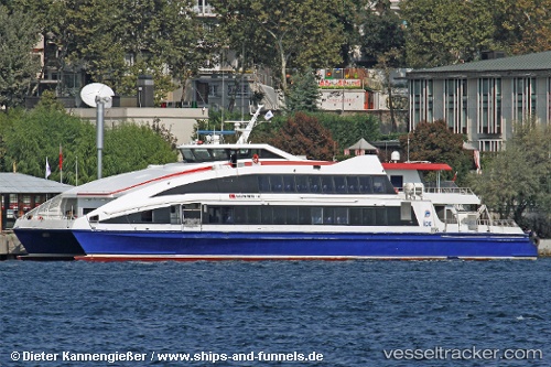
Vessel Salih Reis 4 IMO: 9378096, MMSI: 271002465 Passenger Ship
UTC, 40.95141, 29.09203, course: -1, speed: 0
UTC, 40.95143, 29.09197, course: -1, speed: 0
2026-02-23 17:47:23 UTC, 40.95139, 29.09200, course: -1, speed: 0
Live AIS position:
UTC. Near BOSTANCI),
updated 2026-02-23 17:47:23 UTC.
Find the position of the vessel Salih Reis 4 on the map. The latter are known coordinates and path.
marine traffic ship tracker show on live map
The current position of vessel Salih Reis 4 is 40.95139 lat / 29.09200 lng. Updated: 2026-02-23 17:47:23 UTCCurrently sailing under the flag of Turkey
Salih Reis 4 built in 2007 year
Deadweight:
50 tDetails:
Last coordinates of the vessel:
UTC, 40.95141, 29.09200, course: -1, speed: 0UTC, 40.95141, 29.09203, course: -1, speed: 0
UTC, 40.95143, 29.09197, course: -1, speed: 0
2026-02-23 17:47:23 UTC, 40.95139, 29.09200, course: -1, speed: 0