 vesseltracker.com
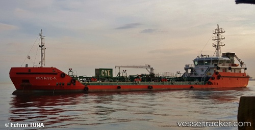
Find the position of the vessel Beykoz e on the map. The latter are known coordinates and path.
marine traffic ship tracker show on live map
The current position of vessel Beykoz e is 40.7173 lat / 29.8853 lng. Updated: 2024-05-02 18:07:10 UTCCurrently sailing under the flag of Turkey
Port of registry:
Istanbul (city in Turkey located at the Bosporus Strait)Payload_mass:
1804 tonneGross tonnage:
1173Service entry:
2014-01-01T00:00:00ZDetails:
Last coordinates of the vessel:
UTC, 40.7299, 29.7128, course: -1, speed: 9.4UTC, 40.7178, 29.8856, course: -1, speed: 0.5
UTC, 40.7173, 29.8854, course: -1, speed: 0.1
2024-05-02 18:07:10 UTC, 40.7173, 29.8853, course: -1, speed: 0