 vesseltracker.com
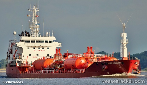
Vessel Duruca IMO: 8916504, MMSI: 271044033 Chemical Oil Products Tanker
UTC, 40.96024, 28.87980, course: 137, speed: 0
2026-02-12 19:11:53 UTC, 40.96024, 28.87980, course: 137, speed: 0
Live AIS position:
UTC. Near BAKIRKOY),
updated 2026-02-12 19:11:53 UTC.
Find the position of the vessel Duruca on the map. The latter are known coordinates and path.
marine traffic ship tracker show on live map
The current position of vessel Duruca is 40.96024 lat / 28.87980 lng. Updated: 2026-02-12 19:11:53 UTCCurrently sailing under the flag of Turkey
Duruca built in 1993 year
Deadweight:
6999 tDetails:
Last coordinates of the vessel:
UTC, 40.96024, 28.87980, course: 137, speed: 0UTC, 40.96024, 28.87980, course: 137, speed: 0
2026-02-12 19:11:53 UTC, 40.96024, 28.87980, course: 137, speed: 0