 vesseltracker.com
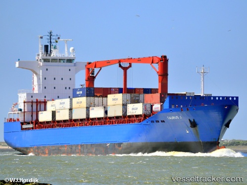
Vessel Mehmet Kahveci A IMO: 9248916, MMSI: 271044302 Container Ship
UTC, 40.96236, 28.67475, course: 355, speed: 0
UTC, 40.96234, 28.67474, course: 355, speed: 0
2026-01-26 14:05:11 UTC, 40.85150, 28.20313, course: 259, speed: 12.9
Live AIS position:
UTC. 13 nm SE of Marmara Ereglisi),
updated 2026-01-26 14:05:11 UTC.
Find the position of the vessel Mehmet Kahveci A on the map. The latter are known coordinates and path.
marine traffic ship tracker show on live map
The current position of vessel Mehmet Kahveci A is 40.85150 lat / 28.20313 lng. Updated: 2026-01-26 14:05:11 UTCCurrently sailing under the flag of Turkey
Mehmet Kahveci A built in 2002 year
Deadweight:
18832 tDetails:
Last coordinates of the vessel:
UTC, 40.96237, 28.67472, course: 355, speed: 0UTC, 40.96236, 28.67475, course: 355, speed: 0
UTC, 40.96234, 28.67474, course: 355, speed: 0
2026-01-26 14:05:11 UTC, 40.85150, 28.20313, course: 259, speed: 12.9