 vesseltracker.com
Find the position of the vessel POLARNET on the map. The latter are known coordinates and path.
marine traffic ship tracker show on live map
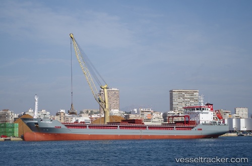
The current position of vessel POLARNET is 38.5007 lat / -8.84293 lng. Updated: 2024-05-02 09:50:02 UTCCurrently sailing under the flag of Turkey
POLARNET built in 2016 year
Port of registry:
Istanbul (city in Turkey located at the Bosporus Strait)Deadweight:
12242 tGross tonnage:
8559Service entry:
2016-01-01T00:00:00ZDetails:
Last coordinates of the vessel:
UTC, 38.5007, -8.84294, course: 139, speed: 0UTC, 38.5007, -8.84296, course: 140, speed: 0
UTC, 38.5007, -8.84295, course: 140, speed: 0
2024-05-02 09:50:02 UTC, 38.5007, -8.84293, course: 140, speed: 0
The ship also appears on the maps: