 vesseltracker.com
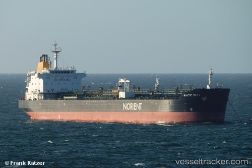
Vessel ULUC KA IMO: 9228801, MMSI: 271051063 Chemical/Oil Products Tanker
UTC, 42.19249, 41.59603, course: 98, speed: 0
UTC, 42.27476, 41.63696, course: 287, speed: 0
UTC, 42.27476, 41.63696, course: 287, speed: 0
2026-01-23 07:35:23 UTC, 42.27477, 41.63697, course: 286, speed: 0
Live AIS position:
UTC. Near KULEVI),
updated 2026-01-23 07:35:23 UTC.
Find the position of the vessel ULUC KA on the map. The latter are known coordinates and path.
marine traffic ship tracker show on live map
The current position of vessel ULUC KA is 42.27477 lat / 41.63697 lng. Updated: 2026-01-23 07:35:23 UTCCurrently sailing under the flag of Turkey
ULUC KA built in 2001 year
Deadweight:
37272 tDetails:
Last coordinates of the vessel:
UTC, 42.19283, 41.59655, course: 113, speed: 0UTC, 42.19249, 41.59603, course: 98, speed: 0
UTC, 42.27476, 41.63696, course: 287, speed: 0
UTC, 42.27476, 41.63696, course: 287, speed: 0
2026-01-23 07:35:23 UTC, 42.27477, 41.63697, course: 286, speed: 0