vessel PRIMORYE IMO: 9236743, vesseltracker.com
Vessel PRIMORYE IMO: 9236743,
MMSI: 273210220 callsign: size: x

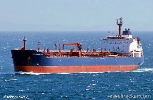
Find the position of the vessel PRIMORYE on the map. The latter are known coordinates and path.

marine traffic ship tracker show on live map

The current position of vessel PRIMORYE is 49.9115 lat / -2.24895 lng. Updated: 2024-05-06 15:56:03 UTC
Payload_mass:
39551 tonne
Gross tonnage:
23236
Service entry:
2001-01-01T00:00:00Z

Manufacturer:
Hyundai Mipo Dockyard (South Korean shipbuilding company)
Details:


Last coordinates of the vessel:
UTC, 49.6451, -3.30331, course: 58, speed: 13.2
UTC, 49.7247, -3.09124, course: 56, speed: 13.5
UTC, 49.8373, -2.64109, course: 75, speed: 14.5
2024-05-06 15:56:03 UTC, 49.9115, -2.24895, course: 77, speed: 15.8


Most frequent ports a vessels calls at PRIMORYE (273210220):

Yosu, traffic: 7
Yeosu, traffic: 5
Sambu, traffic: 5
Singapore, traffic: 5
Taku Bar, traffic: 2
Dagu Bar, traffic: 2
Dagu, traffic: 1
Malacca, traffic: 1
Nakhodka, traffic: 1
Ta-Ku, traffic: 1

Link to the map:


Find another ship

PRIMORYE (273210220) last ports (portcalls and passsages)

Nakhodka | 2022-08-03 19:57:44
Ta-Ku | 2022-07-28 04:39:05
Dagu Bar | 2022-07-28 02:42:55
Taku Bar | 2022-07-25 01:16:17
Taku Bar | 2022-07-21 01:03:21
Malacca | 2022-07-07 13:54:14
Sambu | 2022-07-07 04:50:53
Yosu | 2022-05-08 13:39:30
Yosu | 2022-04-08 05:57:46
Sambu | 2022-03-19 09:20:38
Yosu | 2021-12-27 22:51:50