 vesseltracker.com
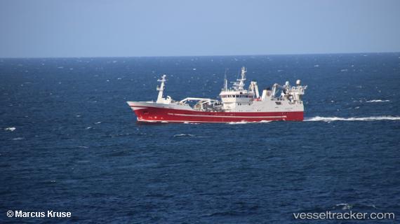
Vessel RUT IMO: 9147174, MMSI: 273298130 Fishing Vessel
UTC, 35.07993, 128.99319, course: 68, speed: 0
UTC, 35.07992, 128.99323, course: 68, speed: 0
2026-01-20 04:11:18 UTC, 35.07992, 128.99327, course: 68, speed: 0
Live AIS position:
UTC. Near Gamcheon/Busan),
updated 2026-01-20 04:11:18 UTC.
Find the position of the vessel RUT on the map. The latter are known coordinates and path.
marine traffic ship tracker show on live map
The current position of vessel RUT is 35.07992 lat / 128.99327 lng. Updated: 2026-01-20 04:11:18 UTCCurrently sailing under the flag of Russia
RUT built in 1997 year
Deadweight:
2500 tDetails:
Last coordinates of the vessel:
UTC, 35.07995, 128.99319, course: 68, speed: 0UTC, 35.07993, 128.99319, course: 68, speed: 0
UTC, 35.07992, 128.99323, course: 68, speed: 0
2026-01-20 04:11:18 UTC, 35.07992, 128.99327, course: 68, speed: 0