 vesseltracker.com
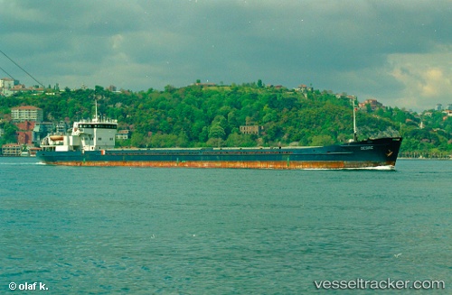
Find the position of the vessel Omskiy 129 on the map. The latter are known coordinates and path.
marine traffic ship tracker show on live map
The current position of vessel Omskiy 129 is 46.3676 lat / 48.0135 lng. Updated: 2025-06-21 16:24:27 UTCPayload_mass:
3174 tonneGross tonnage:
2426Service entry:
1986-01-01T00:00:00ZManufacturer:
Oltenita Shipyard (shipyard in Romania founded in 1940 specialized in the construction of river tugs, ceamuri, shalands, dragees, chainsaws, ships, freighters, icebreakers, etc.)Details:
Last coordinates of the vessel:
UTC, 46.3675, 48.0134, course: -1, speed: 0.5UTC, 46.3674, 48.0134, course: -1, speed: 0.3
UTC, 46.3675, 48.0134, course: -1, speed: 0
2025-06-21 16:24:27 UTC, 46.3676, 48.0135, course: -1, speed: 0.8