 vesseltracker.com
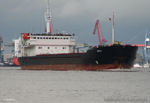
Vessel Volgograd IMO: 8847260, MMSI: 273335500 Multi Purpose Carrier
UTC, 45.42049, 36.78449, course: 144, speed: 7.7
UTC, 45.31045, 36.50621, course: 214, speed: 35.7
2026-01-31 08:38:48 UTC, 45.31045, 36.50621, course: 214, speed: 35.7
Live AIS position:
UTC. Near Kerch),
updated 2026-01-31 08:38:48 UTC.
Find the position of the vessel Volgograd on the map. The latter are known coordinates and path.
marine traffic ship tracker show on live map
The current position of vessel Volgograd is 45.31045 lat / 36.50621 lng. Updated: 2026-01-31 08:38:48 UTCDetails:
Last coordinates of the vessel:
UTC, 45.42049, 36.78449, course: 144, speed: 7.7UTC, 45.42049, 36.78449, course: 144, speed: 7.7
UTC, 45.31045, 36.50621, course: 214, speed: 35.7
2026-01-31 08:38:48 UTC, 45.31045, 36.50621, course: 214, speed: 35.7