 vesseltracker.com
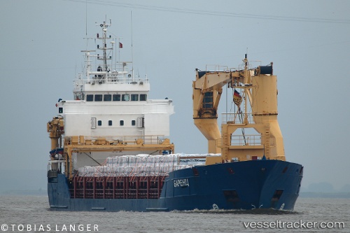
Vessel BARENTS IMO: 9278600, MMSI: 273385970 Multi Purpose Carrier
UTC, 40.34650, 26.63867, course: 217, speed: 13
UTC, 40.02817, 26.17883, course: 256, speed: 12.8
2026-01-30 13:27:49 UTC, 39.89850, 25.85033, course: 222, speed: 12.5
Live AIS position:
UTC. 11 nm W of Bozcaada),
updated 2026-01-30 13:27:49 UTC.
Find the position of the vessel BARENTS on the map. The latter are known coordinates and path.
marine traffic ship tracker show on live map
The current position of vessel BARENTS is 39.89850 lat / 25.85033 lng. Updated: 2026-01-30 13:27:49 UTCCurrently sailing under the flag of Russia
BARENTS built in 2003 year
Deadweight:
4303 tDetails:
Last coordinates of the vessel:
UTC, 40.48400, 26.89833, course: 260, speed: 7.1UTC, 40.34650, 26.63867, course: 217, speed: 13
UTC, 40.02817, 26.17883, course: 256, speed: 12.8
2026-01-30 13:27:49 UTC, 39.89850, 25.85033, course: 222, speed: 12.5