 vesseltracker.com
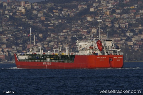
Find the position of the vessel Armada Navigator on the map. The latter are known coordinates and path.
marine traffic ship tracker show on live map
The current position of vessel Armada Navigator is 40.8506 lat / 29.2874 lng. Updated: 2024-04-26 13:59:10 UTCPort of registry:
Taganrog (port city in Rostov Oblast in southern Russia)Payload_mass:
6444 tonneGross tonnage:
4522Service entry:
2004-01-01T00:00:00ZDetails:
Last coordinates of the vessel:
UTC, 40.8506, 29.2874, course: 157, speed: 0UTC, 40.8506, 29.2874, course: 157, speed: 0
UTC, 40.8506, 29.2874, course: 157, speed: 0
2024-04-26 13:59:10 UTC, 40.8506, 29.2874, course: 157, speed: 0