 vesseltracker.com
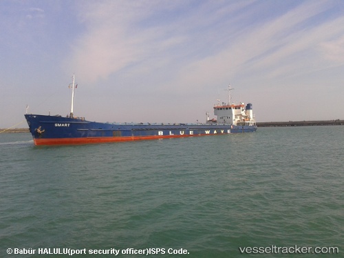
Find the position of the vessel Smart on the map. The latter are known coordinates and path.
marine traffic ship tracker show on live map
The current position of vessel Smart is 47.0813 lat / 39.1795 lng. Updated: 2025-07-03 08:25:33 UTCCurrently sailing under the flag of Russia
Smart built in 1987 year
Deadweight:
3038 tPayload_mass:
3038 tonneGross tonnage:
2597Manufacturer:
Oltenita Shipyard (shipyard in Romania founded in 1940 specialized in the construction of river tugs, ceamuri, shalands, dragees, chainsaws, ships, freighters, icebreakers, etc.)Details:
Last coordinates of the vessel:
UTC, 47.0813, 39.1795, course: 80, speed: 6.3UTC, 47.0813, 39.1795, course: 80, speed: 6.3
UTC, 47.0813, 39.1795, course: 80, speed: 6.3
2025-07-03 08:25:33 UTC, 47.0813, 39.1795, course: 80, speed: 6.3