 vesseltracker.com
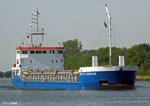
Vessel Baltic Carrier IMO: 9138197, MMSI: 275514000 General Cargo Ship
UTC, 55.65531, 21.15724, course: 101, speed: 0
UTC, 55.65530, 21.15727, course: 101, speed: 0
2026-02-02 21:36:38 UTC, 55.65530, 21.15735, course: 101, speed: 0
Live AIS position:
UTC. Near Klaipeda),
updated 2026-02-02 21:36:38 UTC.
Find the position of the vessel Baltic Carrier on the map. The latter are known coordinates and path.
marine traffic ship tracker show on live map
The current position of vessel Baltic Carrier is 55.65530 lat / 21.15735 lng. Updated: 2026-02-02 21:36:38 UTCCurrently sailing under the flag of Latvia
Details:
Last coordinates of the vessel:
UTC, 55.65530, 21.15728, course: 101, speed: 0UTC, 55.65531, 21.15724, course: 101, speed: 0
UTC, 55.65530, 21.15727, course: 101, speed: 0
2026-02-02 21:36:38 UTC, 55.65530, 21.15735, course: 101, speed: 0