 vesseltracker.com
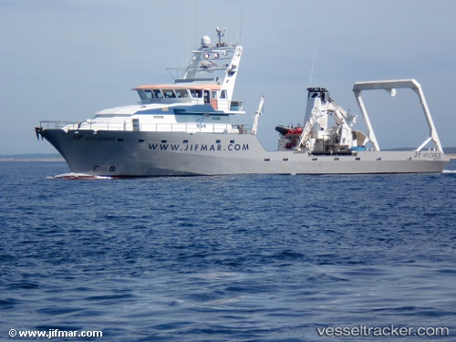
Vessel BALTIC EXPLORER IMO: 8917663, MMSI: 277199040 Utility Vessel
UTC, 55.70381, 21.12682, course: -1, speed: 0
UTC, 55.70375, 21.12669, course: -1, speed: 0
2026-03-04 06:20:59 UTC, 55.70380, 21.12684, course: -1, speed: 0
Live AIS position:
UTC. Near Klaipeda),
updated 2026-03-04 06:20:59 UTC.
Find the position of the vessel BALTIC EXPLORER on the map. The latter are known coordinates and path.
marine traffic ship tracker show on live map
The current position of vessel BALTIC EXPLORER is 55.70380 lat / 21.12684 lng. Updated: 2026-03-04 06:20:59 UTCCurrently sailing under the flag of Lithuania
BALTIC EXPLORER built in 1991 year
Deadweight:
220 tDetails:
Last coordinates of the vessel:
UTC, 55.70385, 21.12671, course: -1, speed: 0.1UTC, 55.70381, 21.12682, course: -1, speed: 0
UTC, 55.70375, 21.12669, course: -1, speed: 0
2026-03-04 06:20:59 UTC, 55.70380, 21.12684, course: -1, speed: 0