 vesseltracker.com
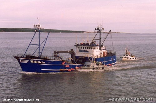
Vessel Billikin IMO: 7397828, MMSI: 303426100 Fishing Vessel
UTC, 54.56676, -165.41309, course: 54, speed: 3.1
UTC, 54.70834, -165.18675, course: 40, speed: 4.7
2026-01-29 15:27:45 UTC, 54.78500, -165.06332, course: -1, speed: 5
Live AIS position:
UTC. 46 nm NE of Akutan),
updated 2026-01-29 15:27:45 UTC.
Find the position of the vessel Billikin on the map. The latter are known coordinates and path.
marine traffic ship tracker show on live map
The current position of vessel Billikin is 54.78500 lat / -165.06332 lng. Updated: 2026-01-29 15:27:45 UTCDetails:
Last coordinates of the vessel:
UTC, 54.48281, -165.50925, course: 48, speed: 5.1UTC, 54.56676, -165.41309, course: 54, speed: 3.1
UTC, 54.70834, -165.18675, course: 40, speed: 4.7
2026-01-29 15:27:45 UTC, 54.78500, -165.06332, course: -1, speed: 5