 vesseltracker.com
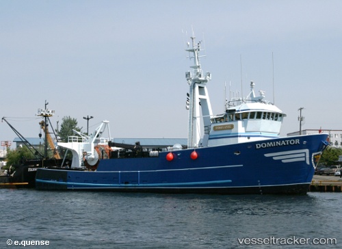
Vessel DOMINATOR IMO: 7940467, MMSI: 303429000 Fishing Vessel
UTC, 53.86988, -166.55190, course: 131, speed: 0
UTC, 53.86986, -166.55185, course: 131, speed: 0
2026-01-31 03:25:11 UTC, 53.86987, -166.55186, course: 132, speed: 0
Live AIS position:
UTC. Near Dutch Harbor),
updated 2026-01-31 03:25:11 UTC.
Find the position of the vessel DOMINATOR on the map. The latter are known coordinates and path.
marine traffic ship tracker show on live map
The current position of vessel DOMINATOR is 53.86987 lat / -166.55186 lng. Updated: 2026-01-31 03:25:11 UTCCurrently sailing under the flag of United States of America
DOMINATOR built in 1979 year
Deadweight:
0 tDetails:
Last coordinates of the vessel:
UTC, 53.84477, -166.58560, course: 197, speed: 9.2UTC, 53.86988, -166.55190, course: 131, speed: 0
UTC, 53.86986, -166.55185, course: 131, speed: 0
2026-01-31 03:25:11 UTC, 53.86987, -166.55186, course: 132, speed: 0