 vesseltracker.com
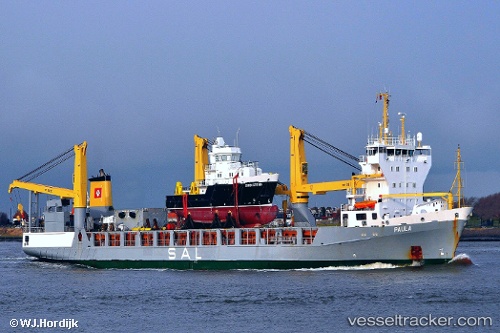
Vessel Paula IMO: 9197466, MMSI: 304010228 Heavy Load Carrier
UTC, 55.09835, 14.65834, course: 272, speed: 4.3
UTC, 55.08933, 14.69170, course: 133, speed: 0
2026-01-15 13:58:05 UTC, 55.08933, 14.69172, course: 132, speed: 0
Live AIS position:
UTC. Near ROENNE),
updated 2026-01-15 13:58:05 UTC.
Find the position of the vessel Paula on the map. The latter are known coordinates and path.
marine traffic ship tracker show on live map
The current position of vessel Paula is 55.08933 lat / 14.69172 lng. Updated: 2026-01-15 13:58:05 UTCCurrently sailing under the flag of Antigua Barbuda
Paula built in 2000 year
Deadweight:
9361 tDetails:
Last coordinates of the vessel:
UTC, 55.11908, 14.54269, course: 95, speed: 4.4UTC, 55.09835, 14.65834, course: 272, speed: 4.3
UTC, 55.08933, 14.69170, course: 133, speed: 0
2026-01-15 13:58:05 UTC, 55.08933, 14.69172, course: 132, speed: 0