 vesseltracker.com
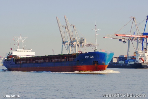
Vessel A S T R A IMO: 9041318, MMSI: 304010285 Multi Purpose Carrier
UTC, 53.23614, 4.46167, course: 203, speed: 9
UTC, 53.01407, 4.10522, course: 231, speed: 10.2
2026-03-02 10:15:59 UTC, 52.78252, 3.73842, course: 220, speed: 9.8
Live AIS position:
UTC. 31 nm N of de Ruyter),
updated 2026-03-02 10:15:59 UTC.
Find the position of the vessel A S T R A on the map. The latter are known coordinates and path.
marine traffic ship tracker show on live map
The current position of vessel A S T R A is 52.78252 lat / 3.73842 lng. Updated: 2026-03-02 10:15:59 UTCCurrently sailing under the flag of Antigua Barbuda
A S T R A built in 1993 year
Deadweight:
3582 tDetails:
Last coordinates of the vessel:
UTC, 53.50431, 4.81093, course: 243, speed: 7.7UTC, 53.23614, 4.46167, course: 203, speed: 9
UTC, 53.01407, 4.10522, course: 231, speed: 10.2
2026-03-02 10:15:59 UTC, 52.78252, 3.73842, course: 220, speed: 9.8