 vesseltracker.com
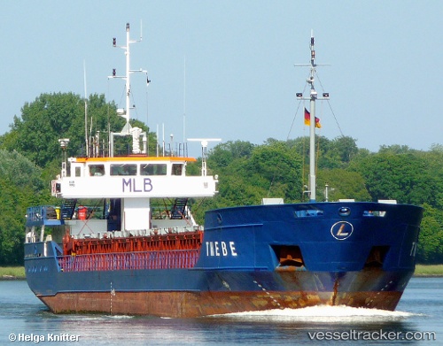
Vessel Thebe IMO: 9199696, MMSI: 304011026 Multi Purpose Carrier
UTC, 61.71043, 4.96350, course: 169, speed: 0.7
UTC, 61.71045, 4.96382, course: 186, speed: 0.2
2026-03-24 21:52:35 UTC, 61.71049, 4.96319, course: 169, speed: 0.4
Live Vessel Thebe Analytics (details, animations, etc.)
Live AIS position: UTC. Near Kalvåg), updated 2026-03-24 21:52:35 UTC.Find the position of the vessel Thebe on the map. The latter are known coordinates and path.
marine traffic ship tracker show on live map
The current position of vessel Thebe is 61.71049 lat / 4.96319 lng. Updated: 2026-03-24 21:52:35 UTCCurrently sailing under the flag of Antigua Barbuda
Thebe built in 2000 year
Deadweight:
2500 tDetails:
Last coordinates of the vessel:
UTC, 61.71032, 4.96462, course: 227, speed: 0.7UTC, 61.71043, 4.96350, course: 169, speed: 0.7
UTC, 61.71045, 4.96382, course: 186, speed: 0.2
2026-03-24 21:52:35 UTC, 61.71049, 4.96319, course: 169, speed: 0.4