 vesseltracker.com
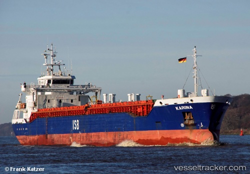
Vessel Karina IMO: 9519808, MMSI: 304047000 Multi Purpose Carrier
UTC, 56.00131, 8.12275, course: 60, speed: 0
UTC, 56.00131, 8.12272, course: 61, speed: 0
2026-02-07 13:57:12 UTC, 56.00128, 8.12269, course: 60, speed: 0
Live AIS position:
UTC. Near HVIDE SANDE),
updated 2026-02-07 13:57:12 UTC.
Find the position of the vessel Karina on the map. The latter are known coordinates and path.
marine traffic ship tracker show on live map
The current position of vessel Karina is 56.00128 lat / 8.12269 lng. Updated: 2026-02-07 13:57:12 UTCCurrently sailing under the flag of Antigua Barbuda
Karina built in 2012 year
Deadweight:
5443 tDetails:
Last coordinates of the vessel:
UTC, 56.00127, 8.12274, course: 60, speed: 0UTC, 56.00131, 8.12275, course: 60, speed: 0
UTC, 56.00131, 8.12272, course: 61, speed: 0
2026-02-07 13:57:12 UTC, 56.00128, 8.12269, course: 60, speed: 0