 vesseltracker.com
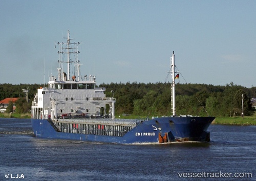
Vessel KAREN IMO: 9487603, MMSI: 304108000 General Cargo
UTC, 51.27534, 3.84394, course: 333, speed: 0
UTC, 51.27535, 3.84395, course: 332, speed: 0
2026-01-17 06:21:12 UTC, 51.27534, 3.84394, course: 332, speed: 0
Live AIS position:
UTC. Near SLUISKIL),
updated 2026-01-17 06:21:12 UTC.
Find the position of the vessel KAREN on the map. The latter are known coordinates and path.
marine traffic ship tracker show on live map
The current position of vessel KAREN is 51.27534 lat / 3.84394 lng. Updated: 2026-01-17 06:21:12 UTCCurrently sailing under the flag of Antigua Barbuda
KAREN built in 2008 year
Deadweight:
4502 tDetails:
Last coordinates of the vessel:
UTC, 51.27533, 3.84395, course: 332, speed: 0UTC, 51.27534, 3.84394, course: 333, speed: 0
UTC, 51.27535, 3.84395, course: 332, speed: 0
2026-01-17 06:21:12 UTC, 51.27534, 3.84394, course: 332, speed: 0