 vesseltracker.com
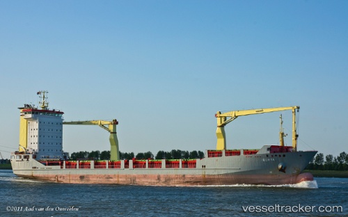
Vessel Olomana IMO: 9184225, MMSI: 304586000 Multi Purpose Carrier
UTC, -34.26067, 176.09927, course: 32, speed: 11
UTC, -34.24544, 176.10942, course: 31, speed: 11.1
2026-01-16 02:00:19 UTC, -33.99774, 176.27483, course: 35, speed: 10.4
Live AIS position:
UTC. 131 nm NE of Russel),
updated 2026-01-16 02:00:19 UTC.
Find the position of the vessel Olomana on the map. The latter are known coordinates and path.
marine traffic ship tracker show on live map
The current position of vessel Olomana is -33.99774 lat / 176.27483 lng. Updated: 2026-01-16 02:00:19 UTCDetails:
Last coordinates of the vessel:
UTC, -34.48766, 175.94514, course: 30, speed: 11.1UTC, -34.26067, 176.09927, course: 32, speed: 11
UTC, -34.24544, 176.10942, course: 31, speed: 11.1
2026-01-16 02:00:19 UTC, -33.99774, 176.27483, course: 35, speed: 10.4