 vesseltracker.com
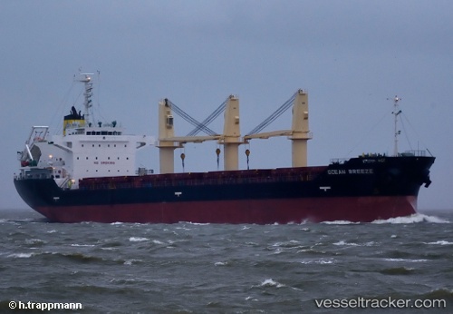
 OCEAN BREEZE
Current Status
Where is the vessel?
OCEAN BREEZE is currently in Near PAROS, based on AIS data received about 2h ago.
Latest AIS update:
Current position: 37.22976° N, 25.09429° E (Near PAROS)
Average speed (last 7 days): Loading…
Average speed (last 30 days): Loading…
Vessel profile: OCEAN BREEZE is a Bulk Carrier with dimensions m x m.
This page combines live AIS, route history, probable destination signals, nearby traffic, and port activity for practical vessel monitoring.
The current position of vessel OCEAN BREEZE is 37.22976 lat / 25.09429 lng. Updated: 2026-03-25 12:23:54 UTCNearest reference points:
- Near Delos
- Near PISO LIVADI
- Near MYKONOS OLD PORT
Currently sailing under the flag of Antigua and Barbuda ![]()
Details:
Live Vessel OCEAN BREEZE Analytics (details, animations, etc.)
Recent AIS points (UTC):
2026-03-25 06:00:42 UTC · 37.40865, 24.98313 · SOG 0.2 kn · COG 14°2026-03-25 08:09:57 UTC · 37.37947, 25.06027 · SOG 4.6 kn · COG 44°
2026-03-25 09:56:44 UTC · 37.32133, 25.08769 · SOG 2.2 kn · COG 96°
2026-03-25 12:23:54 UTC · 37.22976, 25.09429 · SOG 2 kn · COG 87°