 vesseltracker.com
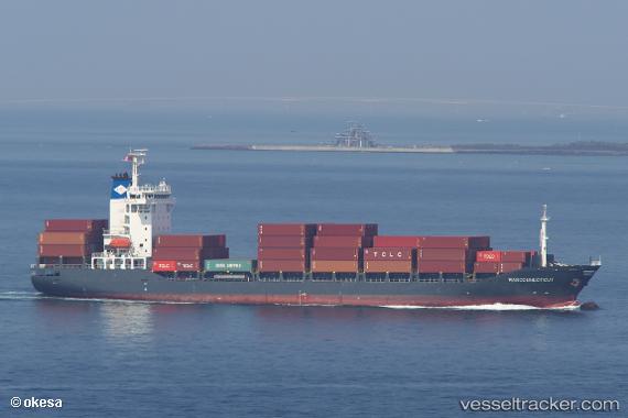
Vessel Marconnecticut IMO: 9343675, MMSI: 305060000 Container Ship
UTC, 34.53465, 138.63701, course: 69, speed: 13.5
UTC, 34.74480, 139.23912, course: 43, speed: 13.4
2026-03-03 19:25:33 UTC, 34.94075, 139.52133, course: 52, speed: 13.3
Live AIS position:
UTC. 12 nm N of Nishitokyo),
updated 2026-03-03 19:25:33 UTC.
Find the position of the vessel Marconnecticut on the map. The latter are known coordinates and path.
marine traffic ship tracker show on live map
The current position of vessel Marconnecticut is 34.94075 lat / 139.52133 lng. Updated: 2026-03-03 19:25:33 UTCCurrently sailing under the flag of Antigua Barbuda
Marconnecticut built in 2007 year
Deadweight:
12774 tDetails:
Last coordinates of the vessel:
UTC, 34.55313, 138.19839, course: 94, speed: 15.2UTC, 34.53465, 138.63701, course: 69, speed: 13.5
UTC, 34.74480, 139.23912, course: 43, speed: 13.4
2026-03-03 19:25:33 UTC, 34.94075, 139.52133, course: 52, speed: 13.3