 vesseltracker.com
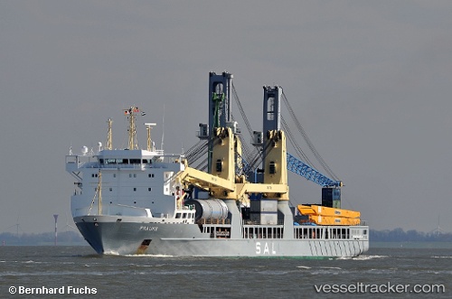
Vessel Frauke IMO: 9376488, MMSI: 305164000 Heavy Load Carrier
UTC, 1.24707, 103.86849, course: 59, speed: 0
UTC, 1.24622, 103.86826, course: 72, speed: 0.1
2026-02-17 10:00:16 UTC, 1.24615, 103.86781, course: 82, speed: 0
Live AIS position:
UTC. Near Choa Chu Kang),
updated 2026-02-17 10:00:16 UTC.
Find the position of the vessel Frauke on the map. The latter are known coordinates and path.
marine traffic ship tracker show on live map
The current position of vessel Frauke is 1.24615 lat / 103.86781 lng. Updated: 2026-02-17 10:00:16 UTCCurrently sailing under the flag of Antigua Barbuda
Frauke built in 2008 year
Deadweight:
12007 tDetails:
Last coordinates of the vessel:
UTC, 1.24732, 103.86737, course: 68, speed: 0UTC, 1.24707, 103.86849, course: 59, speed: 0
UTC, 1.24622, 103.86826, course: 72, speed: 0.1
2026-02-17 10:00:16 UTC, 1.24615, 103.86781, course: 82, speed: 0