 vesseltracker.com
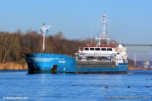
Vessel Elise IMO: 9454462, MMSI: 305170000 Deck Cargo Ship
UTC, 53.91575, 9.20162, course: 267, speed: 0
UTC, 53.91572, 9.20162, course: 266, speed: 0
2026-03-01 20:15:37 UTC, 53.91571, 9.20161, course: 266, speed: 0
Live AIS position:
UTC. Near Ostermoor),
updated 2026-03-01 20:15:37 UTC.
Find the position of the vessel Elise on the map. The latter are known coordinates and path.
marine traffic ship tracker show on live map
The current position of vessel Elise is 53.91571 lat / 9.20161 lng. Updated: 2026-03-01 20:15:37 UTCCurrently sailing under the flag of Antigua Barbuda
Elise built in 2007 year
Deadweight:
3075 tDetails:
Last coordinates of the vessel:
UTC, 54.05716, 9.30841, course: 193, speed: 6.5UTC, 53.91575, 9.20162, course: 267, speed: 0
UTC, 53.91572, 9.20162, course: 266, speed: 0
2026-03-01 20:15:37 UTC, 53.91571, 9.20161, course: 266, speed: 0