 vesseltracker.com
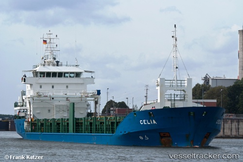
Vessel Celia IMO: 9344394, MMSI: 305176000 General Cargo Ship
UTC, 41.38304, 17.46297, course: 318, speed: 7.8
UTC, 41.58183, 17.19117, course: 314, speed: 7.8
2026-02-22 05:16:30 UTC, 41.68292, 17.05275, course: 315, speed: 8.5
Live AIS position:
UTC. 34 nm N of Bari),
updated 2026-02-22 05:16:30 UTC.
Find the position of the vessel Celia on the map. The latter are known coordinates and path.
marine traffic ship tracker show on live map
The current position of vessel Celia is 41.68292 lat / 17.05275 lng. Updated: 2026-02-22 05:16:30 UTCCurrently sailing under the flag of Antigua Barbuda
Celia built in 2007 year
Deadweight:
4822 tDetails:
Last coordinates of the vessel:
UTC, 41.22379, 17.63153, course: 315, speed: 7.5UTC, 41.38304, 17.46297, course: 318, speed: 7.8
UTC, 41.58183, 17.19117, course: 314, speed: 7.8
2026-02-22 05:16:30 UTC, 41.68292, 17.05275, course: 315, speed: 8.5