 vesseltracker.com
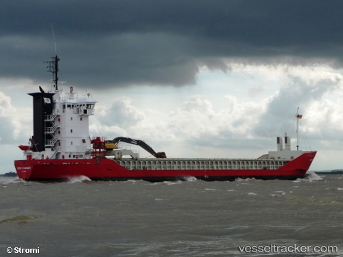
Vessel Feed Stavanger IMO: 9155951, MMSI: 305224000 Multi Purpose Carrier
UTC, 54.40675, 11.89326, course: 93, speed: 9.4
UTC, 54.44048, 12.21632, course: 42, speed: 9.8
2026-03-02 15:43:48 UTC, 54.70240, 12.61241, course: 58, speed: 9.6
Live AIS position:
UTC. 16 nm N of Zingst),
updated 2026-03-02 15:43:48 UTC.
Find the position of the vessel Feed Stavanger on the map. The latter are known coordinates and path.
marine traffic ship tracker show on live map
The current position of vessel Feed Stavanger is 54.70240 lat / 12.61241 lng. Updated: 2026-03-02 15:43:48 UTCCurrently sailing under the flag of Antigua Barbuda
Feed Stavanger built in 1997 year
Deadweight:
4163 tDetails:
Last coordinates of the vessel:
UTC, 54.51658, 11.39280, course: 116, speed: 10.1UTC, 54.40675, 11.89326, course: 93, speed: 9.4
UTC, 54.44048, 12.21632, course: 42, speed: 9.8
2026-03-02 15:43:48 UTC, 54.70240, 12.61241, course: 58, speed: 9.6