 vesseltracker.com
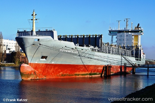
Vessel Neuenfelde IMO: 9231846, MMSI: 305287000 Container Ship
UTC, 53.68871, 9.50132, course: 346, speed: 11.7
UTC, 53.71883, 9.46983, course: 316, speed: 10.1
2026-01-14 08:16:03 UTC, 53.89216, 9.14300, course: 48, speed: 2.1
Live AIS position:
UTC. Near Kiel Canal),
updated 2026-01-14 08:16:03 UTC.
Find the position of the vessel Neuenfelde on the map. The latter are known coordinates and path.
marine traffic ship tracker show on live map
The current position of vessel Neuenfelde is 53.89216 lat / 9.14300 lng. Updated: 2026-01-14 08:16:03 UTCCurrently sailing under the flag of Antigua Barbuda
Neuenfelde built in 2001 year
Deadweight:
11390 tDetails:
Last coordinates of the vessel:
UTC, 53.54583, 9.85300, course: 288, speed: 11.4UTC, 53.68871, 9.50132, course: 346, speed: 11.7
UTC, 53.71883, 9.46983, course: 316, speed: 10.1
2026-01-14 08:16:03 UTC, 53.89216, 9.14300, course: 48, speed: 2.1