 vesseltracker.com
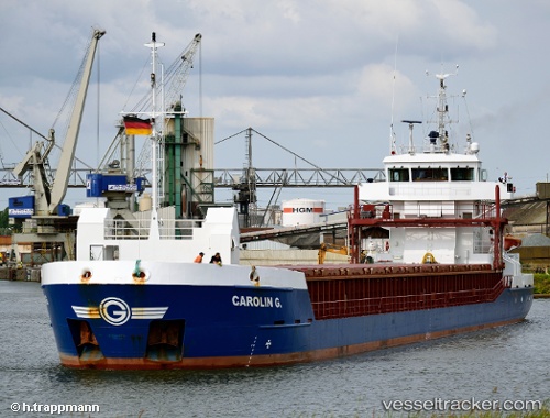
 Carolin G.
Current Status
Where is the vessel?
Carolin G. is currently in Near Bahrenfeld, based on AIS data received about 1h ago.
Latest AIS update:
Current position: 53.54575° N, 9.84694° E (Near Bahrenfeld)
Average speed (last 7 days): Loading…
Average speed (last 30 days): Loading…
Vessel profile: Carolin G. is a Multi Purpose Carrier with dimensions 88m x 12m.
This page combines live AIS, route history, probable destination signals, nearby traffic, and port activity for practical vessel monitoring.
The current position of vessel Carolin G. is 53.54575 lat / 9.84694 lng. Updated: 2026-03-25 07:44:05 UTCNearest reference points:
- Near Bahrenfeld
- Near Hamburg-Mitte
- Near WEDEL
Currently sailing under the flag of Antigua Barbuda ![]()
Carolin G. built in 2008 year
Deadweight:
3797 tDetails:
Live Vessel Carolin G. Analytics (details, animations, etc.)
Recent AIS points (UTC):
2026-03-25 01:28:16 UTC · 53.61692, 9.54757 · SOG 0.2 kn · COG 291°2026-03-25 03:31:15 UTC · 53.61672, 9.54729 · SOG 0.1 kn · COG 297°
2026-03-25 06:17:55 UTC · 53.57459, 9.63529 · SOG 7.8 kn · COG 120°
2026-03-25 07:44:05 UTC · 53.54575, 9.84694 · SOG 5.5 kn · COG 106°