 vesseltracker.com
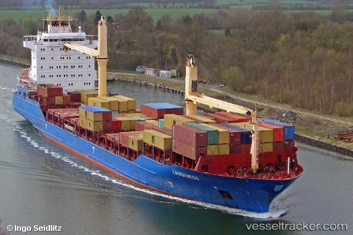
Vessel Langeness IMO: 9301134, MMSI: 305506000 Container Ship
UTC, 12.33500, -81.18667, course: -1, speed: 12
UTC, 12.71167, -81.36333, course: -1, speed: 12
2026-01-15 14:28:10 UTC, 13.07667, -81.53167, course: -1, speed: 11
Live AIS position:
UTC. 31 nm N of San Andrés),
updated 2026-01-15 14:28:10 UTC.
Find the position of the vessel Langeness on the map. The latter are known coordinates and path.
marine traffic ship tracker show on live map
The current position of vessel Langeness is 13.07667 lat / -81.53167 lng. Updated: 2026-01-15 14:28:10 UTCCurrently sailing under the flag of Antigua Barbuda
Langeness built in 2006 year
Deadweight:
17002 tDetails:
Last coordinates of the vessel:
UTC, 12.05596, -81.05861, course: 336, speed: 11.3UTC, 12.33500, -81.18667, course: -1, speed: 12
UTC, 12.71167, -81.36333, course: -1, speed: 12
2026-01-15 14:28:10 UTC, 13.07667, -81.53167, course: -1, speed: 11