 vesseltracker.com
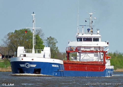
Vessel Heinz G. IMO: 9536521, MMSI: 305612000 Multi Purpose Carrier
UTC, 52.46595, 4.59982, course: 268, speed: 0
UTC, 52.51624, 4.21320, course: 285, speed: 10.6
2026-01-30 21:27:22 UTC, 52.47779, 3.84653, course: 205, speed: 9.5
Live AIS position:
UTC. 13 nm NW of de Ruyter),
updated 2026-01-30 21:27:22 UTC.
Find the position of the vessel Heinz G. on the map. The latter are known coordinates and path.
marine traffic ship tracker show on live map
The current position of vessel Heinz G. is 52.47779 lat / 3.84653 lng. Updated: 2026-01-30 21:27:22 UTCCurrently sailing under the flag of Antigua Barbuda
Heinz G. built in 2010 year
Deadweight:
3850 tDetails:
Last coordinates of the vessel:
UTC, 52.40617, 4.87383, course: 327, speed: 0UTC, 52.46595, 4.59982, course: 268, speed: 0
UTC, 52.51624, 4.21320, course: 285, speed: 10.6
2026-01-30 21:27:22 UTC, 52.47779, 3.84653, course: 205, speed: 9.5