 vesseltracker.com
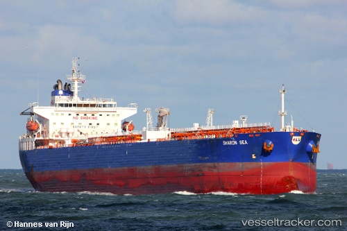
Vessel CHEMTRANS NOVA IMO: 9316232, MMSI: 305617000 Crude Oil Tanker
UTC, 29.92897, -89.97700, course: 298, speed: 0
UTC, 29.92892, -89.97697, course: 298, speed: 0
2026-03-14 17:33:06 UTC, 29.92900, -89.97698, course: 297, speed: 0
Live Vessel CHEMTRANS NOVA Analytics (details, animations, etc.)
Live AIS position: UTC. Near Meraux), updated 2026-03-14 17:33:06 UTC.Find the position of the vessel CHEMTRANS NOVA on the map. The latter are known coordinates and path.
marine traffic ship tracker show on live map
The current position of vessel CHEMTRANS NOVA is 29.92900 lat / -89.97698 lng. Updated: 2026-03-14 17:33:06 UTCCurrently sailing under the flag of Antigua and Barbuda
Details:
Last coordinates of the vessel:
UTC, 29.92898, -89.97702, course: -1, speed: 0UTC, 29.92897, -89.97700, course: 298, speed: 0
UTC, 29.92892, -89.97697, course: 298, speed: 0
2026-03-14 17:33:06 UTC, 29.92900, -89.97698, course: 297, speed: 0