 vesseltracker.com
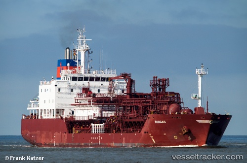
Vessel Rhogas IMO: 9618848, MMSI: 305793000 Lpg Tanker
UTC, 59.23130, 5.52208, course: 95, speed: 0
UTC, 59.23240, 5.52399, course: 164, speed: 0
2026-01-28 11:46:16 UTC, 59.23202, 5.52266, course: 124, speed: 0
Live AIS position:
UTC. Near VESTRE BOKN),
updated 2026-01-28 11:46:16 UTC.
Find the position of the vessel Rhogas on the map. The latter are known coordinates and path.
marine traffic ship tracker show on live map
The current position of vessel Rhogas is 59.23202 lat / 5.52266 lng. Updated: 2026-01-28 11:46:16 UTCCurrently sailing under the flag of Antigua Barbuda
Rhogas built in 2012 year
Deadweight:
8643 tDetails:
Last coordinates of the vessel:
UTC, 59.23118, 5.52214, course: 94, speed: 0UTC, 59.23130, 5.52208, course: 95, speed: 0
UTC, 59.23240, 5.52399, course: 164, speed: 0
2026-01-28 11:46:16 UTC, 59.23202, 5.52266, course: 124, speed: 0