 vesseltracker.com
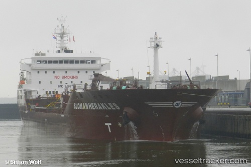
Vessel Sloman Herakles IMO: 9466726, MMSI: 305851000 Chemical Oil Products Tanker
UTC, 53.71321, 9.48233, course: 320, speed: 12.4
UTC, 53.88139, 9.21434, course: 274, speed: 13
2026-01-17 02:52:57 UTC, 53.84032, 8.80335, course: 279, speed: 14.7
Live AIS position:
UTC. Near Altenbruch Reede),
updated 2026-01-17 02:52:57 UTC.
Find the position of the vessel Sloman Herakles on the map. The latter are known coordinates and path.
marine traffic ship tracker show on live map
The current position of vessel Sloman Herakles is 53.84032 lat / 8.80335 lng. Updated: 2026-01-17 02:52:57 UTCCurrently sailing under the flag of Antigua Barbuda
Sloman Herakles built in 2012 year
Deadweight:
16417 tDetails:
Last coordinates of the vessel:
UTC, 53.56204, 9.74371, course: 279, speed: 7.9UTC, 53.71321, 9.48233, course: 320, speed: 12.4
UTC, 53.88139, 9.21434, course: 274, speed: 13
2026-01-17 02:52:57 UTC, 53.84032, 8.80335, course: 279, speed: 14.7