 vesseltracker.com
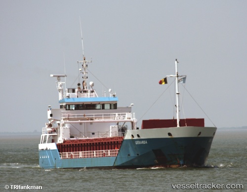
Vessel KARESSA IMO: 9341770, MMSI: 305912000 General Cargo Ship
UTC, 56.88833, 12.47833, course: -1, speed: 0
UTC, 56.88833, 12.47833, course: -1, speed: 0
2026-03-02 11:47:43 UTC, 56.88954, 12.47982, course: -1, speed: 0
Live AIS position:
UTC. Near FALKENBERG),
updated 2026-03-02 11:47:43 UTC.
Find the position of the vessel KARESSA on the map. The latter are known coordinates and path.
marine traffic ship tracker show on live map
The current position of vessel KARESSA is 56.88954 lat / 12.47982 lng. Updated: 2026-03-02 11:47:43 UTCCurrently sailing under the flag of Antigua and Barbuda
KARESSA built in 2006 year
Deadweight:
4537 tDetails:
Last coordinates of the vessel:
UTC, 56.88916, 12.47864, course: -1, speed: 0UTC, 56.88833, 12.47833, course: -1, speed: 0
UTC, 56.88833, 12.47833, course: -1, speed: 0
2026-03-02 11:47:43 UTC, 56.88954, 12.47982, course: -1, speed: 0